File:Idaho Regional Hunt Units.svg
From Wikimedia Commons, the free media repository

Size of this preview: 389 × 600 pixels. Other resolutions: 156 × 240 pixels | 311 × 480 pixels | 498 × 768 pixels | 664 × 1,024 pixels.
Original file (SVG file, nominally 5,069 × 7,813 pixels, file size: 245 KB)
| Description |
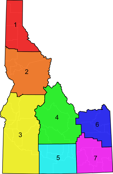
An SVG map of Utah showing the 5 regional hunt units. The units are semi-transparent so that county boundaries can be visualized. Data from here. |
| Date | (UTC) |
| Source | |
| Author |
|
|
I, the copyright holder of this work, hereby publish it under the following license:
|
Original upload log[edit]
This image is a derivative work of the following images:
- File:Blank_Map_of_Idaho.svg licensed with PD-self
- 2011-04-02T06:24:30Z Ninjatacoshell 5069x7813 (120150 Bytes) {{Information |Description=A blank SVG map of Idaho showing the 44 counties. |Source=*[[:File:Map_of_Idaho_highlighting_Idaho_County.svg|]] |Date=2011-04-02 06:22 (UTC) |Author=*[[:File:Map_of_Idaho_highlighting_Idaho_County.
Uploaded with derivativeFX
File history
Click on a date/time to view the file as it appeared at that time.
| Date/Time | Thumbnail | Dimensions | User | Comment | |
|---|---|---|---|---|---|
| current | 06:31, 2 April 2011 | | 5,069 × 7,813 (245 KB) | Ninjatacoshell (talk | contribs) | {{Information |Description=An SVG map of Utah showing the 5 regional hunt units. The units are semi-transparent so that county boundaries can be visualized. Data from [http://www.ultimateidaho.com/images/idsectionmap.jpg here]. |Source=*[[:File:Blank_Map_ |
- You cannot overwrite this file.
File usage on Commons
The following page links to this file: