File:Oregon Regional Hunt Units.svg
From Wikimedia Commons, the free media repository

Size of this preview: 800 × 597 pixels. Other resolutions: 320 × 239 pixels | 640 × 478 pixels | 1,024 × 764 pixels | 1,280 × 955 pixels.
Original file (SVG file, nominally 6,461 × 4,821 pixels, file size: 251 KB)
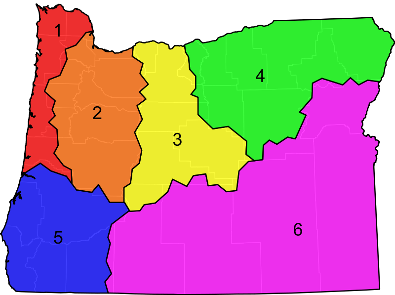
| Description | An SVG map of Utah showing the 5 regional hunt units. The units are semi-transparent so that county boundaries can be visualized. Note that the State of Oregon also considers the Snake River, the Columbia River, and the Pacific Coast as regional units, but these are not depicted on the map.
Data from the Oregon Department of Fish and Wildlife. |
|
| Date | (UTC) | |
| Source | ||
| Author |
|
|
I, the copyright holder of this work, hereby publish it under the following license:
|
Original upload log[edit]
This image is a derivative work of the following images:
- File:Blank_Map_of_Oregon.svg licensed with PD-self
- 2011-04-06T04:39:36Z Ninjatacoshell 6461x4821 (151328 Bytes) {{Information |Description=A blank SVG map of Utah showing the 36 counties. |Source=*[[:File:Map_of_Oregon_highlighting_Columbia_County.svg|]] |Date=2011-04-06 04:37 (UTC) |Author=*[[:File:Map_of_Oregon_highlighting_Columbia
Uploaded with derivativeFX
File history
Click on a date/time to view the file as it appeared at that time.
| Date/Time | Thumbnail | Dimensions | User | Comment | |
|---|---|---|---|---|---|
| current | 04:54, 6 April 2011 | | 6,461 × 4,821 (251 KB) | Ninjatacoshell (talk | contribs) | {{Information |Description=An SVG map of Utah showing the 5 regional hunt units. The units are semi-transparent so that county boundaries can be visualized.<br><br><table border="0" cellspacing="0" cellpadding="1" style="background:transparent"> <tr valig |
- You cannot overwrite this file.
File usage on Commons
The following page links to this file: